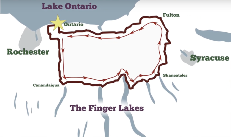
Jim Bondra created a new 300k route for our region this year at our RBA's request. Pete had wanted a route that he could run early in the season (when snow on the ground was likely) that would have manageable elevation and include lots of services. The idea was a route that would help with PBP qualifications this year. I'd already done a 300k in Florida but wanted to keep the mojo moving, so I accepted Pete's invitation to pre-ride it mid-week. My recollection was that he was planning to ride it together.
 Route for Jim's Early 300k.
I took a day off work and drove up to Pete's house on the shore of Lake Ontario to join him and his friend Nat Watson for the start of "Jim's Early 300k" in near-freezing temperatures. I had donned multiple layers for the 7 AM start, including lobster cloves lined with light wool liners, a buff, and a wool cap with ear flaps. All of it was needed as we rolled toward the second and third controls through Webster, Macedon, and Farmington. These roads are shared with many other of Pete's routes, but this was the first time I had ridden them on a weekday in cold weather. I noticed noisy flocks of birds in the bare trees, the occasional patch of snow in a ditch, and the "conk-la-ree" of the newly returned red-wing blackbirds, occasionally visible perched on nearby reeds. Nat had gone ahead, Pete was a little behind, and I was in the middle, listening to the birds and wondering what happened to our "stick together" plan. Had I heard wrong?
I'd decided on my aluminum Fuji for this day, knowing there were still likely salty wet patches on the road, and not wishing to offer my steel bike to the rust gods. I'd fitted a large transverse saddlebag behind me to hold the extra layers and a small bar bag up front for munchies. I had set cues on my route every 5 miles so that my phone would remind me to "Eat, eat, eat!" and sip the sugary electrolyte mix from my water bottles. A few breakfast bars disappeared as I rolled along. Somewhere along the way, I passed Nat.
After Farmington, the way forward departed from the frequently-run Women's Rights 200k route and continued south while tacking now and again into a headwind until we reached Canandaigua. I stopped at a Byrne Dairy, the third control, and went inside to buy a hot breakfast sandwich and coffee. I'd almost finished my food when Nat, then Pete, rolled in. After a little chat back and forth about that headwind, Nat started off on the eastbound leg of what turned out to be a long stretch of exposed road and a tailwind.
The lighter and more aerodynamic Fuji is faster than my Rivendell. It's not usually my go-to bike for brevets because it doesn't have dynamo lighting or fenders. But today, it felt like it was pedaling itself for about 20 miles as I followed Nat. Realizing the opportunity for free speed and effortless miles, I leaned into it a little and easily cruised ahead at 20 mph for about an hour. I continued to eat and drink on cue, passing through Geneva to catch a brief glimpse of Seneca Lake and then finally slowing down in Seneca Falls for some pizza. It was a leisurely 20-minute stop, but I didn't see Pete or Nat for the remainder of the ride.
The next couple of hours took me across the tops of Cayuga, Owasco, and Skaneateles Lakes. The farmland is enjoyable enough, but I really enjoy pedaling up to a body of water. This area of the state is called the Finger Lakes Region, and we are the Finger Lakes Randonneurs, after all, so it follows that these are the stars of the ride for me. The northern sections of the lakes exist in relatively flat land compared to their southern tips. It's interesting to contrast the experience of riding this northern section of our region with where I live. This is a great early-season ride.
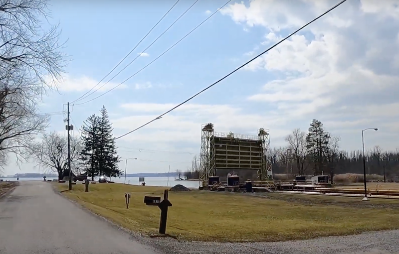
 Cayuga outlet lock.
I'm thinking about where to get dinner now, but I settle for a package of cheap cookies from a gas station, where I fill the water bottles again with the sticky sports drink powder that has worked quite well for me today. I figure, "I'll get dinner north a little further along," as I cross the Erie Canal Trail (now the Empire State Trail), the railroad, and Interstate 90 (the Thruway). These three landmark transportation routes seem to cut the state in half, like three blades through the landscape, and I notice them for the second time in the day.
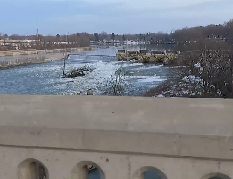
I pass through Baldwinsville and watch the Seneca River pass beneath me on the bridge. It soon joins the Oneida River to form the Oswego River, and its combined discharge flows north to Oswego, dumping much of the Finger Lakes water into Lake Ontario. I can't help but pay attention to the flow of the water through this section of the state, another of its key features. I've dropped a few hundred feet in elevation following the water downhill, but something about this area has retained the snow in these low elevations on the surrounding fields. My guess is that the snowbelt dumped a little more of the white powder here than elsewhere. It will probably be gone in a week or so, but today, the lowering sun is reflected brilliantly off the white surface. Small backwaters of the Oswego River are inexplicably still frozen.
 Oswego River in Fulton.
I reached Fulton a little before sundown and eat a pre-packaged sandwich and a Coke at a convenience store, stashing an extra sub in my back pocket for later. I don the reflective gear again, turn on the battery-powered lights, and head west towards the finish. The route mercifully skirts north of the drumlin fields through Red Creek and Wolcott, sparing me from the "death by a thousand cuts" of those tiny but endless hills. I stop once more with 35 miles left to go and eat my "pocket sub" before continuing on familiar roads through Sodus, Williamson, and Ontario. I finish in a little more than 16.5 hours.