What do they say? When you get lemons, make lemonade? In the summer of 2023, my employer faced budget shortfalls, resulting in a round of layoffs to balance the books. My sudden, subsequent job search had yet to yield any job opportunities. So, here I was, pre-registered for PBP, having trained all year, and now had to decide if I should abandon the ride before getting on the plane. Gay and I discussed it, and I shared that I thought PBP was too important for me to abandon, and she agreed.
Despite having decided to proceed with the mission, I was stressed by the decision. I needed a break and started thinking about a week-long tour to clear my head and get away from unemployment insurance paperwork, the COBRA bill, and the conversations with recruiters responding to my LinkedIn profile with lousy offers. I needed to disengage and come back fresh.
I planned this trip to start out the front door and venture out of the Finger Lakes region, into the Tug Hill area to the north, and through some of the dirt and seasonal roads of the Adirondacks. I bought the Sam Hillborne for rando and light touring, but my rides had been all the former and none of the latter. I'd go camping, seeking free, primitive spots near water. I don't have any lightweight stuff the cool kids have for bike packing. I fastened my rear rack to the back, attached a basket to the front rack, and then filled a set of panniers and a homemade basket bag with my puffy sleeping bag and pad, clothes, a cooking stove, fuel, a mosquito net, and other odds and ends.
There's a guy with a website that points out every free parking space and primitive campsite in the state. I found some close enough to the road and some water and wove my route to and between these waypoints. I was going to do this as cheaply as possible. I strapped my 2-person tent to the rack, wrapped in a blue tarp for my 4 camping nights. I'd stay with my parents near Utica on the fourth night and then return home.
As I was planning, a job opportunity started to form. I debated staying home and waiting for the phone to ring but quickly discarded that idea. I could check my email occasionally, and that would have to do. I started to see this break from work as less of a stroke of bad luck and more like a newfound chance to get some hilly miles in my legs, dragging a load from campsite to campsite.
Day 1: Ithaca to Morgan Hill State Forest (45 miles)
Jim said he'd be up for joining me after he got off work for my first night. I spent that Friday morning repeatedly filling and emptying my bags, ensuring I had what I thought I needed. I have a good list for rando rides, but I couldn't say the same for a tour. It's different, and I was second-guessing myself. I had been bringing a video camera on rides for the past couple of years, but I couldn't find it for this ride. Oh well, this one is pictures only.
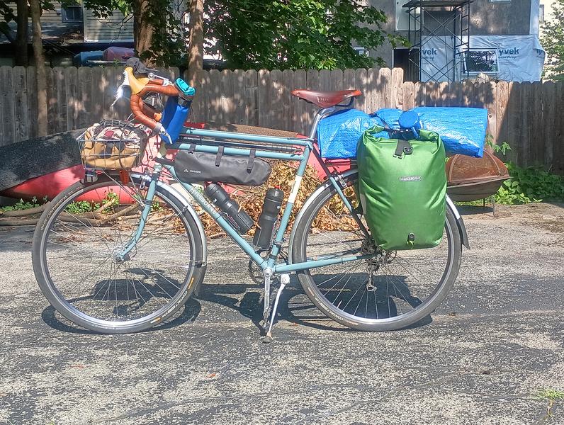 My Sam in Touring Mode.
It was a hot afternoon when we met and started the 45-mile ride out of Ithaca. Jim's bike had a few bags strapped onto the handlebars and from his saddle to hold his lightweight gear, whereas my setup looked a little more like a traditional touring bike. It was much heavier than I am used to. When climbing out of the saddle, the bike swung back and forth under me lethargically, like it wanted to return to the garage and take a nap.
We slow-pedaled along Fall Creek towards Cortland, where we stopped at the Taco Bell for an early dinner, then proceeded east through the Tioughnioga River valley on side roads. The hot sun dropped in the sky behind us as cows lulled in the fields. A stop in Truxton allowed us to grab sodas and wrapped muffins for the morning before heading up towards Labrador Hollow, welcoming its slightly cooler air after sweating in the late afternoon heat. We headed up a hill and searched for the primitive campsite on the map.
I had no assurance that these campsites I was targeting existed, but I figured I could camp almost anywhere in the state forest land if push came to shove. The map said the campsite would be near Shackham Pond, so I walked the trail down to the pond to find a couple young guys paddling around the small body of water. There was a small campsite near the water on a bit of rise, complete with a fire ring, so I went back to the road to tell Jim, who was watching the bikes.
We set up the tents quickly, and then I put on swim trunks and went for a quick swim at the far side of the pond, where there was a pebbly shore that quickly gave way to a muddy bottom a few feet from the water's edge, which released bubbles and silt with each step. I floated on my back in the lukewarm water, listening to the kayaker's banter from the other side of the pond. Upon returning, I realized there were gravestones on the other side of a tree near the fire ring and a bent sign 10 feet up on that tree that declared that this was not (despite all appearances) a campsite. The light was such that we determined it was too late to move.
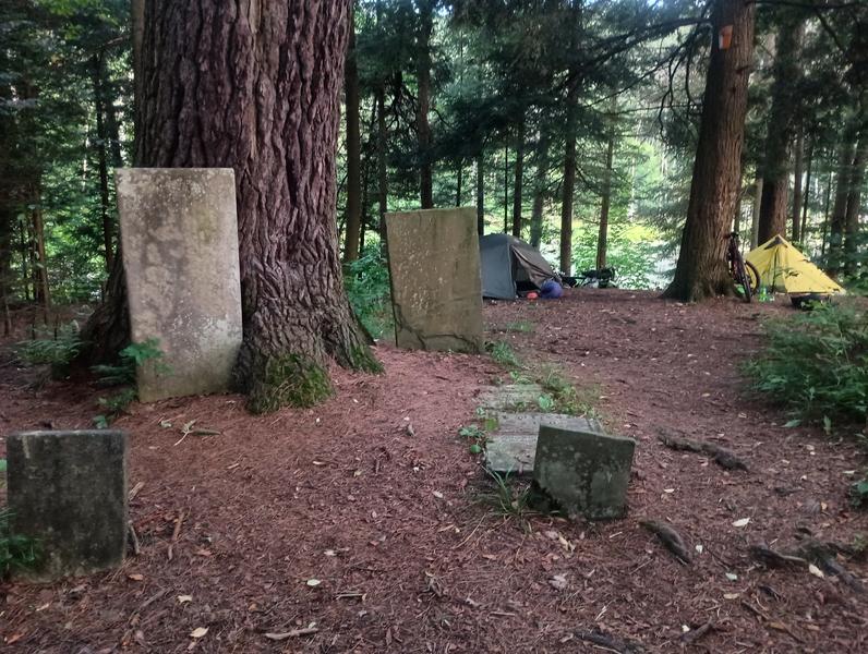 Always room for more at our campsite.
I err on asking forgiveness rather than seeking permission to camp in such spaces. It begged the question, "When is camping camping?" What if I just sat on this log and leaned against a tree to grab a nap for a few hours? What if I lay on the ground and did the same? If I put a blanket over me? A tarp around me? One can rationalize their actions for anything. My rationale was that we needed to sleep, were not lighting a fire or cooking on the stove, and would be gone before anyone came through in the morning. Frogs croaked non-stop through the night, which I found relaxing.
Day 2: Morgan State Forest to Salmon River Reservoir (90 miles)
After eating our muffins and drinking warm sodas the next morning, we repacked the bikes. Looking at the site, you'd never know we were there. Jim headed home while I moved on. The sun was up quickly, and I made my way towards a country store in Fabius that I recalled made little homemade donuts. Upon arriving, I saw it was under new ownership, and they no longer made donuts. I ordered a breakfast sandwich and a coffee and sat outside to eat while calling my kids to see if they were home in Manlius. I'd swing by their town and have a second breakfast before heading to the Tug Hill. I sat in the back seat a couple hours later while these newly licensed drivers chauffeured me to Dave's Diner. I caught up on their busy lives while eating a bowl of freshly baked, warm granola.
A few miles north of the kids' house, I jumped on the Erie Canal Trail in Fayetteville and headed east toward Rome to get around Oneida Lake. The canal trail is flat and traffic-free, and I was enjoying the sun and the leisurely pace while ringing my bell as I approached other cyclists and walkers. I crossed the Erie Canal at lock 21, then left the cinder trail to head north. I had all day to climb up the shoulder of Tug Hill and find my campsite on the shore of the Salmon River Reservoir, so I stopped to cool my head in Fish Creek in Taberg, inadvertently scaring a little boy also enjoying the coolness of the stream, much to his mother's amusement.
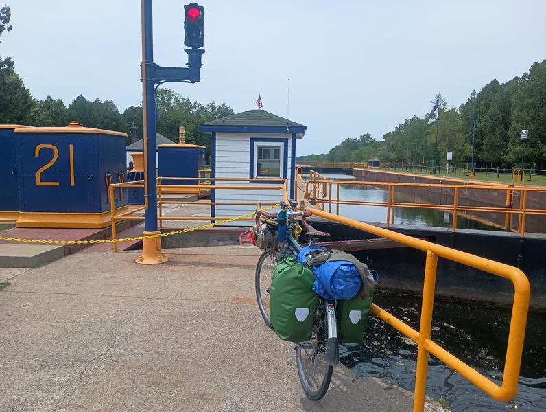 Lock 21 in Rome, NY
I arrived in Redfield with plenty of daylight to spare. The town was busy with people up to enjoy the cool water on this hot Saturday. The corner store was busy with people buying drinks and ice while motorcyclists were hanging out at the bar across the street. I grabbed a couple Cokes from the air-conditioned store and made short work of them outside, watching small groups of ATVs cruising by on the road.
According to the map, a site could be found on the southeast side of the lake, and I had noted the spot on my GPS. Following the road along the south shore, I soon came upon the spot. I turned in and found a small camper in a site near the road. The camper, a father with three young girls, told me he thought some sites may be available near the water. The short dirt road down to those sites was rutted and muddy, with rocks protruding from the center ridge in unfortunate angles. I bounced over the rocks and around the mud to find a great spot. Another camper was parked at a nearby site. It appeared that they were having an extended stay.
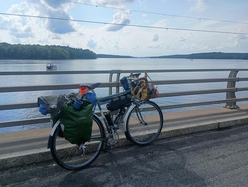 Salmon River Reservoir in Redfield.
I set up the tent, then took a dip in the reservoir. Having cooled off, I decided to grab a bite at the Redfield Square, the small bar in town I had seen earlier. I parked my bike outside the bar, up on its kickstand beside the black Harleys and Indians, while I went in. I ordered a burger, fries, and a Coke while I watched the well-inebriated bikers (all of whom seemed to know each other) come and go. I finished my dinner and headed back to the tent.
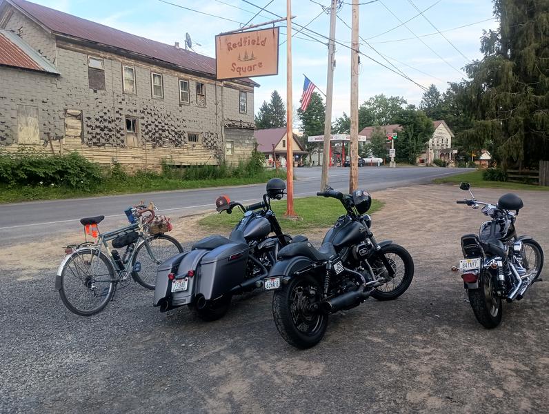 'When in Rome', as they say.
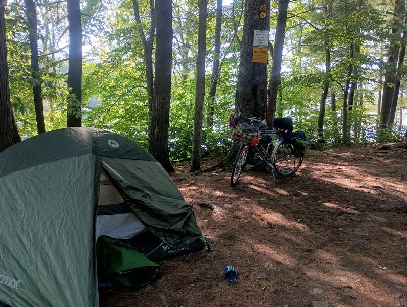 It looked peaceful enough, before the partiers arrived.
I climbed into my bag with a book and started reading as dusk set in. Visitors came down the rutted road on Harleys and in loud cars as I did. It was Saturday night in the sticks, and the locals came out to get drunk, work on their motorcycles and cars, and play loud music 30 feet from my tent. I tried to be a good sport, hoping they would eventually knock it off. They never did. At some point after midnight, I heard another loud Harley flying down the path, a loud crashing sound, followed by the shrill shouts of the angry woman rider about the destruction wrought upon her engine by the rocks in the road. She couldn't get it started again but didn't stop trying for about 30 minutes; someone offered to jump it since she killed the battery trying.
A fuse blew in my head after 2 am when a repeated booming bass from a car stereo visibly vibrated the walls of my tent. I flew out of the tent and started shouting at everyone. Everyone looked astonished that I was be complaining, and I was suddenly surrounded by drunks telling me that I should show them some respect, to which I got even more nuts. The shouting match went on for about 5 minutes. No one gave up any ground. In retrospect, it wasn't a great night of camping. I left as soon as the sun came up. They never went to bed and were still making a racket when I left.
Why didn't I pack up and move? I don't know. I vented to a local outside the little town store while drinking my coffee. He nodded knowingly. Apparently, they'd been having issues on the weekends. Just my luck.
Day 3: Tug Hill, Black River, Stillwater to Moss Lake (91 miles)
My intentions for this day were to maximize my time on dirt, seasonal, and logging roads. I wasn't familiar with these roads, so I was prepared to roll with the punches as I had decided to roll the dice and trust Ride with GPS's routing capabilities. It's my go-to app for bicycle routing, but I did a lot of on-the-fly rerouting myself to avoid gated roads through private lands not accounted for by RWGPS.
The first such reroute was required just a few miles outside of Redfield when I encountered an overgrown and gated snowmobile path intended only for passage by the winter vehicles that would glide several feet above its rocks and ruts. I returned to a main road and headed north to another possible off-pavement shortcut over the plateau.
The second shortcut was through land leased by the Mad River Club on Little John Rd. Upon encountering the signed gate across the road, I reversed course until I found a spot where I could get one bar of cell service. I did a quick search and contacted the club president to ask if I could ride through, only to be told they couldn't allow it for insurance reasons. I asked a local if he knew of a viable alternative, and he pointed me to a dirt road through the Little John Wildlife Management Area. As long as I kept moving faster than the speed of a mosquito, this road was a real treat.
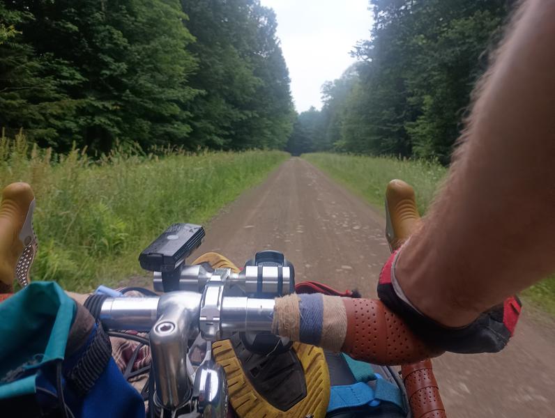 Little John Wildlife Management Area.
I popped out on some road in the middle of nowhere where a table was set up as a rest stop for the North Winds Gravel Classic, a "race" through the same area I was touring. I never saw the riders or support staff for the race, but we may have traveled some of the same roads. I zigged and zagged my way eastward to the wind farm area west of the Black River Valley that separates the Adirondack region from the Tug Hill. The view from the top of that ridge was captivating, and the descent into Lowville was a blast, even if I was a little cautious with all the extra weight of my gear.
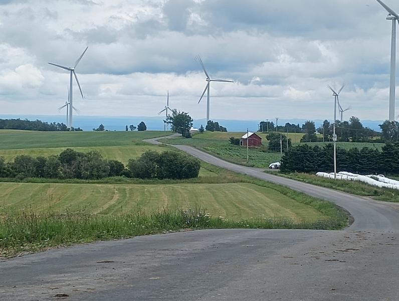 Wind farm on the eastern side of the Tug Hill Plateau.
I stopped in Lowville at a "Stewart's Shops" for some water, then again for a quick lunch at a deli after crossing the Black River. Belly full, I headed up Number Four Road to Stillwater Rd, watching the sky darken as I climbed. Just as I hit the dirt section of Stillwater Road, the rain started to fall. I paused to cover my front basket with a plastic sheet, switched shoes for sandals, and put on my rain jacket. By the time I reached Stillwater Reservoir, my drivetrain was feeling crunchy from the sandy gravel mix characteristic of the Adirondacks. The owner of the Stillwater Hotel tossed me towels across the bar to dry off while I waited for a big bowl of mac and cheese and drank a couple of Cokes.
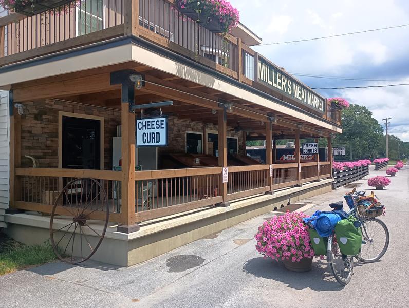 Miller's Meat Market, festooned with flowers, but closed on that day.
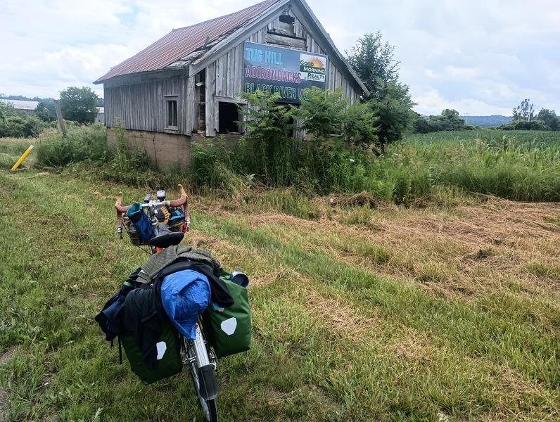 The Black River lies between the Tug Hill and Adirondacks.
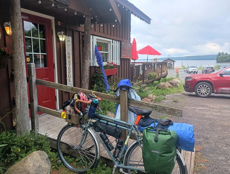 Stillwater Hotel.
By the time I finished the meal, the rain had subsided, and I kept moving along the south side of the reservoir on Big Moose Road, a 10-mile section of rollers that passes a few bays of the reservoir. It was passable on my 37 mm tires, but I wouldn't recommend anything narrower. The return to pavement occurred near Big Moose Lake, but the rolling terrain continued to my campsite on Moss Lake, a former girls' camp with several free campsites.
I set up at a site that overlooked the lake, changed, and jumped in the clear water to clean and cool off. I filled my bottles with filtered water and cooked a couple packages of ramen while I listened to loons across the water. While I ate, I watched chipmunks shamelessly kissing on a branch of a nearby tree for about 30 minutes. This place was perfect. I had the lake to myself, a welcome change from the night before. I fell asleep quickly and got a fantastic night's rest.
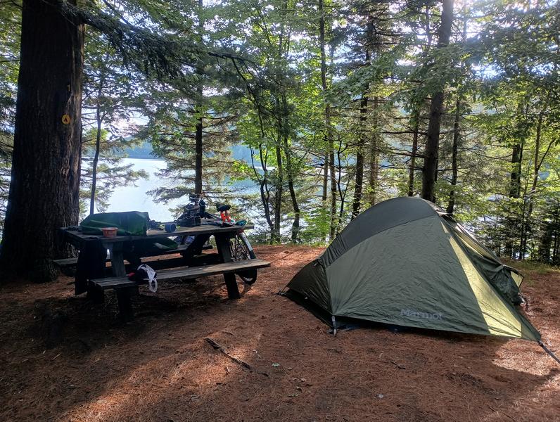 A perfectly restful spot at Moss Lake.
Day 4: Moose River Plains, Indian Lake, Ferris Lake Wild Forest (93 miles)
I slept in a little, enjoying this little slice of paradise, before riding into Eagle Bay to get some donuts and a coffee, then buying some supplies in a little store in Inlet. I looked forward to another day with plenty of off-pavement riding through the Moose River Plains. After a climb to Limekiln Lake, I stopped to register, like you might at a hiking trailhead. A couple leaving the area in a pickup truck with two mountain bikes hanging on the tailgate stopped to chat for a little bit. Other than a few vehicles parked at one of the 116 campsites in the region, that would be the last bit of traffic I'd see for 23 miles.
The road was rough and rocky, and it was some work to haul all my gear through the region, but it was worth all of the effort. Once over the first few wooded passes, the road flattens and becomes more of a passage through wetlands with an open sky. Blackflies weren't out, but plenty of mosquitos to outrun again. Crossings over tannic tributaries to the Moose River, such as Silver Flow, made for picturesque photos with the mountains in the distance only slightly obscured by the smoky haze from the Ontario wildfires. I'd never been back to this part of the woods, but now it's on my list for an extended visit.
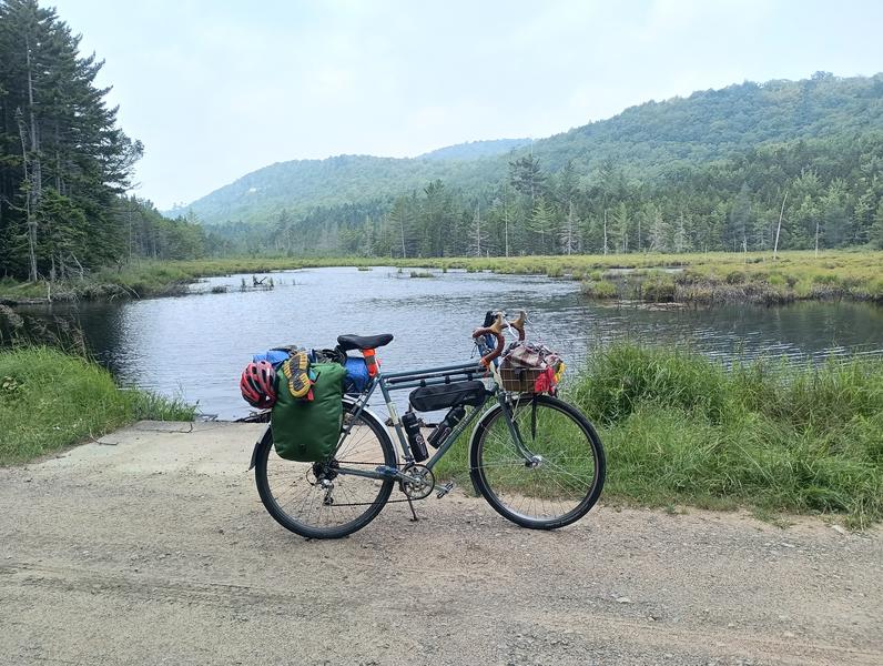 Silver Flow, a tannic tributary of Moose River.
After a few miles of these open spaces, the climbing resumed to top out at 2600 ft just south of Wakely Mountain, followed by a great dirt descent to a ranger station and a place to check out of the region. I cooled down in the Cedar River for a few minutes while filtering water for my bottles again. The sun was baking me, and the smoke seemed more prevalent. I had a big lunch at the Stewart's Shop in Indian Lake before heading south on Route 30.
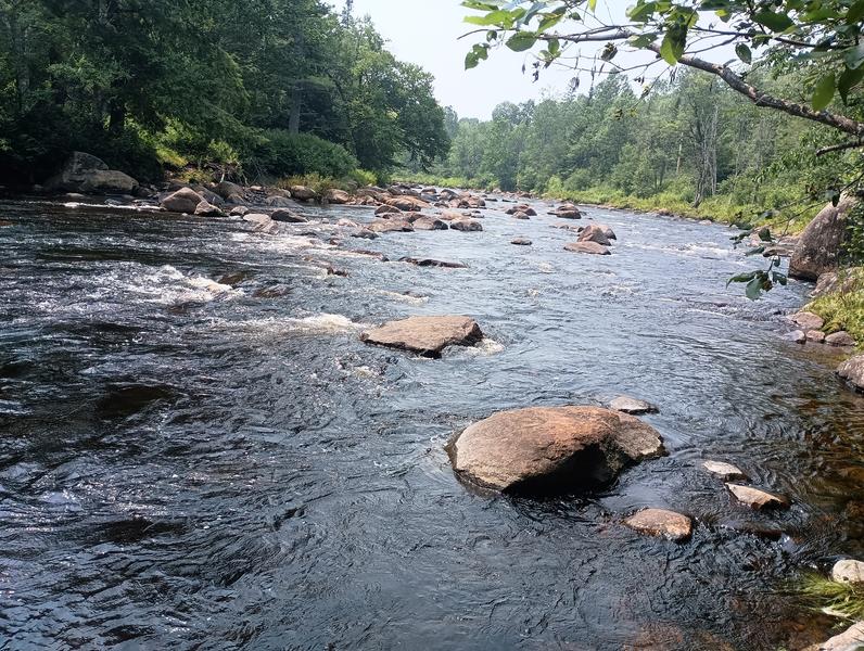 Cooling water from the Cedar River after leaving the Moose River Plains.
These were not exotic roads, and I wished there were other side passages to take to reach Piseco Lake. I passed two other cyclo-tourists going north, each wearing masks to protect themselves from the smoke particles. I was probably achieving the same as smoking a pack by breathing it in all day...so much for the health benefits. I pressed on past Mason Lake, my fallback plan for a campsite if Piseco seemed too far, and stopped to enjoy a cold drink and a sandwich while resting atop a pallet of topsoil at Charlie John's in Speculator.
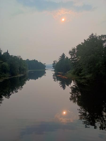 An eerie sun in a grey sky over the mirror-like Piseco Outlet on a hot day.
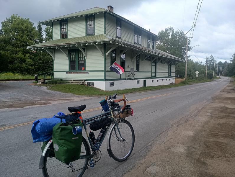 Big Moose Station, a restaurant near Big Moose Lake.
As I crossed over the Piseco Lake Outlet, I stopped to talk with someone fishing under the bridge. As he told me about his younger days racing BMX, he cast his line near a line of rope floats. The fish he hooked quickly entangled his line around weeds and the ropes. While he tried to figure out how to salvage his expensive spoon, he told me he had to quit racing after the sport caused trouble with his knees. I watched him try to free his line while admiring the deep orange sun hanging low in the smoke-gray sky before moving on.
I reached my streamside campsite along Powley Road, a seasonal road through the Ferris Lake Wild Forest. I chose a spot just feet off the road on one side and a few feet from the East Canada Creek on the other. I cooled and cleaned off by laying flat in the shallow, rocky creek for a bit and then cooked a big pot of dried beans and rice while donning long pants and a shirt to keep the mosquitos at bay. After eating, the light was just about gone, so I got in the tent for another fantastic night of sleep. Not a car came down the road all night.
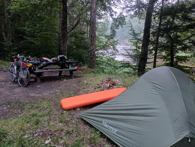 Powley Rd. Campsite on East Canada Creek.
Day 5: Mohawk Valley to my Parent's (43 miles)
After packing in the morning, I continued south to Stratford and grabbed breakfast at the counter of the Trailside Deli while listening to the locals discuss a black bear making mischief. I wasn't going far on that day, just down into the Mohawk Valley and then a few miles to the south to my folk's house near Frankfort.
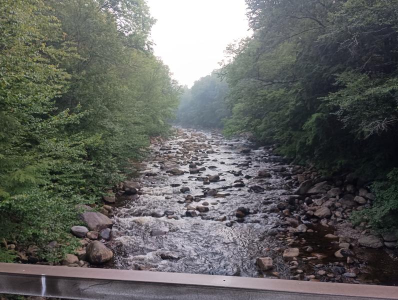 East Canada Creek crossing on Powley Rd.
After 26 miles, I was back on the Erie Canal trail and stopped to check out the Mohawk River in Little Falls, Lock 18 on the canal, the Fort Herkimer Church just off the trail, and had a soda at the marina in Ilion. In Frankfort, I turned off the trail onto Cemetery St. and began the climb up what used to be called Coop Hill Rd. I had hoped that a few years of training would have made the hill that had been my childhood nemesis an easier climb than I remembered. Still, it was the hardest climb of the entire trip, and I barely made it to the top, paperboying my heavy rig where necessary on the steepest pitch. I reached my childhood home (and still my parents') in the early afternoon. I spent the afternoon visiting, and we grabbed some Greek food in town before I headed to bed early.
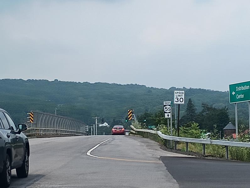 "Coop Hill", still a hard climb.
Day 6: Utica, Rome, Syracuse, and Ithaca
My father woke up early to make me eggs for breakfast so I could be on the road early. I dropped into Utica and passed a Dollar General at the bottom of the hill, formerly a grocery store that was the setting for my first job. I rolled down Bleeker Street, hoping that one of the Italian bakeries might be open, but it was still too early to grab a pasticiotti to stash away for later. I hopped on North Genessee St. to grab the canal trail again and made my way towards Rome.
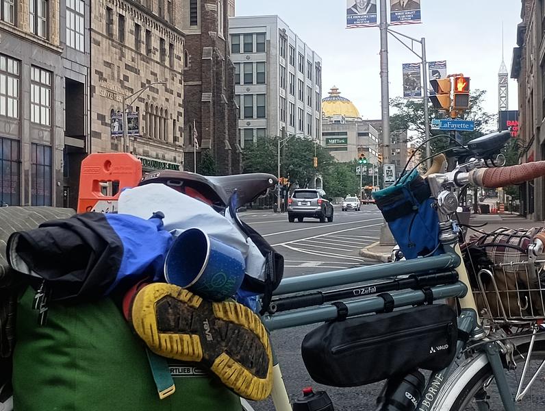 Gold Dome Bank in Utica
It was a foggy morning, and I encountered a few cyclotourists out early, traveling in small groups, taking their time, some with four full panniers, others in a tour group, bags likely toted in a van. I pulled out my Bluetooth speaker and put on some tunes as I cruised along the flat path. I had over 120 miles to go, so I put my head down and churned out the miles.
Near Fort Stanwix in Rome, I caught wind of a delicious smell of sausages cooking from the Iron Kettle, a restaurant wonderfully caught in a 50's time warp. I was a "honey" here and received frequent coffee refills of the tiny cup while I ate a second breakfast at their counter, in sight of my bike, which leaned unlocked against the front window. A half-hour later, I was on my way again, past the historic Fort, down some side streets, and back on the trail, backtracking the path I had taken a few days before until I reached Fayetteville.
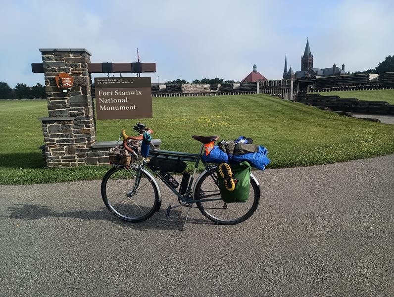 Historic Fort Stanwix in Rome.
I called ahead to the kids and met them and a friend for ice cream by the Swan Pond in Manlius. We hung out for 30 minutes, then made my way to Jamesville and Apulia, the last real climb of the trip. Fortunately, I got a tailwind to aid me south through Preble, Cortland, and finally back home, 132 miles for the day.
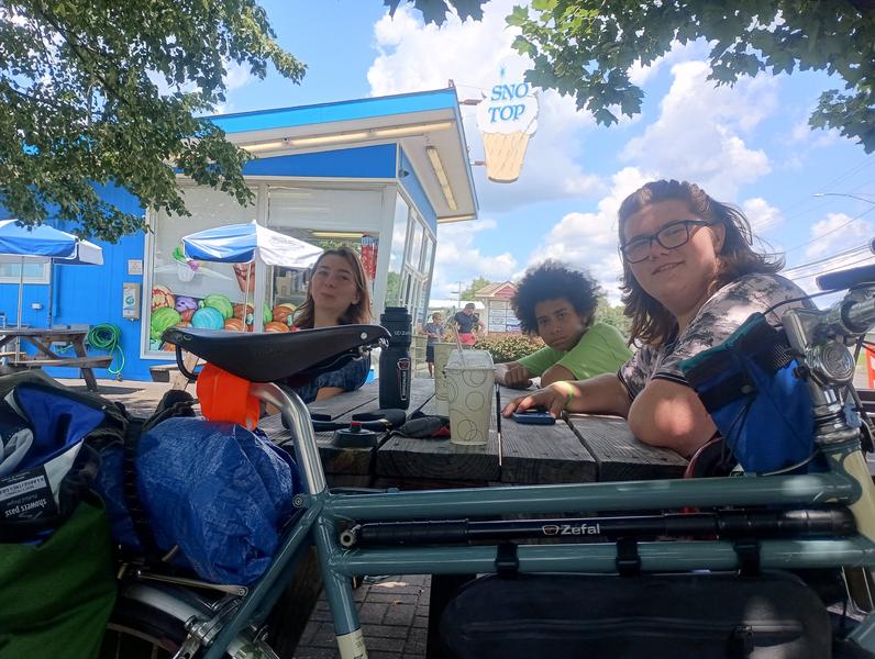 Getting ice cream with the kids in Manlius.
During the week, I received no calls regarding my employment situation, but quickly after my return I received some contract work for a few months. It was the right move to take advantage of the lull in my work schedule to get in some challenging miles and to let myself explore a little. Paris-Brest-Paris was just over a month away, and I felt ready for it.