The last ride on my plan for the year was Stuart's 600k which followed the Lake Ontario shoreline from Ontario, NY to Chaumont Bay, over the Tug Hill to Hamilton, Sylvan Beach, and back to Ontario.
Planning a Sleep Stop
Left to my own, I probably would not have finished this ride. I knew how to pack my tools, clothing layers, do the essential repairs, eat and drink throughout the day, and was in good enough shape. However, I had it in my head that I should cowboy/stealth camp someplace after about 400k. I was holding pretty tight to this in email exchanges with the RBA and the other riders two days before the ride.
This was a summer ride with a forecast for pretty clear skies and seasonal temperatures for New York in June. I thought I could find a park pavilion under which to crash for two or three hours and tried to convince myself and the others that this would be a viable strategy. If this sounds crazy, you are in good company.
This 600k brevet would be an adventure on a couple of levels. First, it would take me over a relatively large part of the state on many roads I had never ridden. Second, it was a physical and mental adventure to spend that long in the saddle, in the heat, bonking, then getting second and third winds, primarily alone with my thoughts. Of course, I knew that this would be the case going in. Still, my brain thought I needed to toss in another element of excitement for some reason. Maybe it would be fun to leave to chance where I would rest after riding more than two centuries on the first day. Let's try sleeping outside!
Part of the reason for my thinking was a hotel used in previous years as a sleep stop had closed. None of the other riders thought my plan was a good one. I eventually allowed myself to be convinced to share a 3-bed suite with two of the other riders. I'm grateful everyone was persistent and that I ultimately softened to the idea. Unfortunately, the weather changed, and I needed the bed. It would have been a disaster.
Ontario to Oswego to 58 miles, 2600 ft of climbing
The route started at 5 am the RBA's house in Ontario, just as all of my brevets had so far. Another similarity to previous brevets in this region was that few people had arrived to participate. Paul and JB (with whom I had ridden the Niagara 400k a few weeks prior) had come back up from NYC and NJ. Larry (who I had met on the Women's Rights 200k in the spring) was also riding this one. I am not sure why this area doesn't seem to have many randonneurs. Maybe randonneuring here is on a decline, or perhaps it's simultaneously too extreme for some and not extreme enough for others.
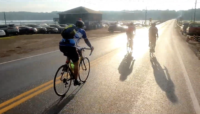
After a group photo was taken, Pete Dusel rode with us for a while out towards Sodus Bay. We caught the sunrise over the lake as we followed the Lake Ontario shoreline through the village of Pultneyville, just a few miles from the start. My read of the forecast was for nice weather for both days of the ride. The morning sky was partly cloudy, and the temperature was just right for riding. Sodus Bay is a pleasant village, and I've ridden there from Ithaca a few times before. When I have, I've stopped for lunch at a restaurant, visited the beach, and walked on the pier, but we were just passing through on this ride.
 Sunrise over Lake Ontario as we get going.
 Approaching Sodus Bay
We passed through Fair Haven and Sterling, inland from the shore, and then proceeded to Oswego, the twin towers of the power station visible beyond the SUNY campus on the lakeshore. All four of us reached the control together at about 9:30 am. I knew I was the slow rider of the group, so my strategy was to grab and go at the controls when I could. I filled my bottles, downed a quart of chocolate milk, grabbed a breakfast sandwich, and was on my way as everyone else sat down to eat and rest a bit.
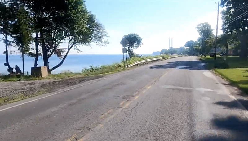 Oswego
Oswego to Chaumont: 63 miles, 2100 ft of climbing
After my NASCAR-fast control stop, I crossed the bridge over the Oswego River. When traveling, I am always drawn to the streams, rivers, and lakes and the watersheds that they define. All the water under the bridge had come from so far around the central New York areas I'll be riding through. I'll be near the outlet of this Great Lake when I reach the next control. We'll pass over the Tug Hill area later during the ride and into the Oneida Lake basin as daylight ends. Finally, I'll end the day at a sleep stop not far from the headwaters of the Susquehanna River.
There was a mild tailwind, and I considered pushing it to try to stay ahead for as long as I could, but I held back. It's that sort of thinking that will have me blowing up before this ride really gets started. Paul and JB, riding together and probably trading puns, are first to catch up and pass me probably 75 or 80 miles into this ride. I remind myself that there is a lot of cycling to do today; I'm riding my comfy but heavy Sam Hillborne with a bag full of tools and parts; I'm using platform pedals and Vans. I'm not going to be "winning" anything, and I need to just keep a steady forward motion.
There is a general store at mile 94 across the street from Selkirk Shores State Park that we all must have marked on our maps, cue sheets, or GPS routes. I buy a gallon of water and some ice. Paul and JB are finishing up their stop as I fill up my bottles. It is getting pretty hot, and this stretch of road is pretty exposed. As Larry pulls into the store driveway, I indicate that I have about a half-gallon of water left he might as well use. Maybe it will bring me some good karma later.
I leave the stop a bit ahead of Larry, but he catches up quick, and we spend a bit of time talking. I asked him how he got into randonneuring and listened to his stories, which quickly passed the time. I did the same with Paul and JB earlier in the day. Everyone's stories strike a chord with me. Eventually, we reach Henderson Harbor together a little before 8 hours into the ride. Larry tells me about a brevet he did years ago on which a secret control was placed on the side road we were riding to ensure the riders stayed on the marked route. I'm listening, but I'm struck by how beautiful this place seems, the bright sun making the lake sparkle blue, and make a mental note to come to visit again. We've ridden a century before 1 pm!
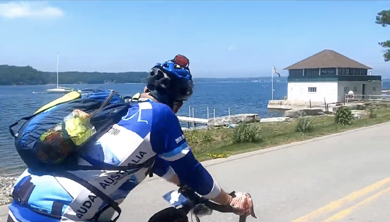 Larry rides with me through Henderson Harbor.
The route changed directions, and a headwind caught me as we turned left to head north around mile 111. Larry didn't seem too affected and pulled on ahead as if there was no wind at all. Maybe I was bonking or feeling dehydrated, or just didn't have the legs. Whatever the case, I pushed myself upwind to pass over the Black River in Dexter (another watershed moment!) and then to Chaumont (the second control) a little past 200k by 2:30 pm. A third of this ride was done. Paul and JB were halfway through their Subway subs as I ordered mine with extra pickles and spent about 30 minutes savoring it. Larry brought his own lunch in his backpack. Spouses and family members are texted and called to keep them up to speed.
Everyone leaves as I sit for a few more minutes in a booth in the air-conditioned convenience store, sucking in giant swallows of Coke through a straw. I realize this is the exact opposite of my strategy at the first control, but I think I need to relax for a few, so I stay for about 30 minutes.
Chaumont to Camden: 62 miles, 2500 ft of climbing
The route doubles back for a few miles as I leave Chaumont and head east towards the Tug Hill region. Looking at the elevation profile in preparation for the ride, I noticed two significant climbs on the course. The Tug Hill climb was the first. I had ridden the Tug Hill from the south during a spring permanent and was looking forward to cycling over it from the north side this time.
In reality, the legs that included these climbs had no more cumulative elevation gain than the others. Still, it certainly felt different as the heat of the day continued to sap away my energy. The first part of the climb to Adams included a few short, steep sections on which I just barely crept along. After stopping at every red light in the small village, I eventually reached Stewart's convenience store. I bought gummy worms for the bag, chocolate milk, and a couple bottles of V8 (one for immediate consumption, one for later). I've had mixed luck with V8. Either it's just the salts that my body craves, or it's battery acid in a bottle. Somehow, I'm still experimenting with food at the end of my brevet season.
I was sure I would have seen Larry at this stop, as he planned to fill up his bottles here. I'd heard that he was efficient at controls, but even so, I'm surprised to have missed him and worry that I'm really slowing down. I've only gone about 23 miles since the control (143 miles overall), and it's about 5:20 pm. Paul, JB, and I have planned to share a sleep stop in Madison at mile 230 (not quite 2/3 of the overall ride). After doing some quick rando-math (230 minus 140 is 90, estimate 10mph...what's that? 9 hours?), I figure I'll be sleeping by 2:30 am. Imprecise math is ever going on in my mind as I calculate arrival times at the next control, town, or watering hole and the day and ride overall. How long will I sleep?
The second part of the climb was a 10-mile low-grade slog from Adams to Redfield with a few steep sections. Mostly, it's that sort of climbing that doesn't look like climbing but feels like something mechanical must be wrong. A rubbing brake or a super soft tire could produce the same effect. The V8 is consumed, and many gummy worms meet their demise. Quite the pairing.
Riding through the Tug Hill forested areas is a nice change from the exposed areas near the lake. The streams run black with tannins, and the smells of the woods waft about me. I ride by a house with a few trucks parked in the driveway. Several guys call out to me as I ride by. They're half in the bag and beckon me to get off the bike and join them. I wave as I roll by. They drove by in a roaring pickup truck a few minutes later, hollering amicably out the window.
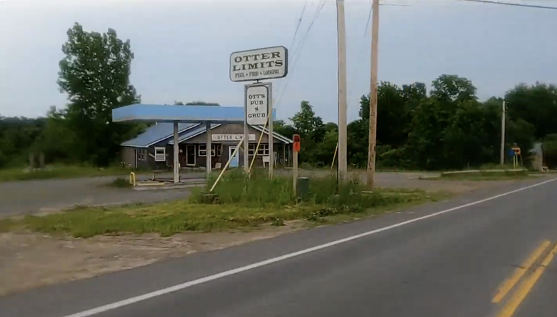 Comical name to an abandoned restaurant on Tug Hill
I pass over the high point on this climb and pick up some speed, only to have it scrubbed by rollers. I pass by the Salmon River Reservoir, admire it for a second, then continue along the carless roads. At some point, I notice the sun starting to go down and don the requisite reflective gear and light the lights.
As I approach the final descent down into Camden, the trees clear as I enter open farmland. With the canopy opened up, I noticed a fantastic sunset in progress. I also see that beyond the pinks, the sky includes several ominous-looking clouds to the south. Unfortunately, I didn't bring any rain gear. There was just a slight chance of rain when I checked the forecast.
I roll into the Fastrac convenience store in Camden around 9 pm. My stomach is a little sour from the odd mix I've been eating, but I still need some fuel. I drink some milk and watch the customers come in and out. There's a guy who's had too much to drink who's irritating people in the parking lot who seem to know him. They shrug him off. He wanders my way to watch me unwrap the dry ham sub I just bought from its plastic. He fills me in on his cycling exploits while I get ready to take off again. 15 minutes in Camden tonight is just about enough. I'm just shy of halfway done with the entire ride. Math tells me I'll be sleeping at 2 am now.
Camden to Westmoreland: 28 miles, 500 ft of climbing
I still was eating that sub, taking tiny bites and swallowing it down with a sip of water a few miles from the Camden control, when I started to feel light sprinkles of rain in the dark. I try to make sure the bags are closed up as best as possible and finish off the sandwich before the heavy rain hits.
I cross Fish Creek and the Barge Canal in a steady rain. I'm pretty soaked. The temperature is still tolerable as long as I'm working. I know it's not going to stay that way, though, and if I need to stop to fix something, it's going to feel very different. I realize that I'll need to make some sort of poncho at the following control for the climb to Madison later.
There's an old Camaro in the ditch near the old Erie Canal. The driver said he just missed the turn and slid off in the rain a few minutes ago. Help is on the way, and he says that he's ok. I am grateful that he didn't slide off the road through me. I arrive in Westmoreland control around 11:30 pm and make a hot chocolate at the convenience store to warm up. The clerk remembers all three of the cyclists passing through not long ago. He provides me with a big trash bag and scissors to make an arts and crafts raincoat. I'm still on track for sleep at 2 am, if I don't hang out for long.
Westmoreland to Madison: 19 miles, 843 ft of climbing
The elevation profile shows this as the second big climb, but it was pretty easy. The sub has given me a second wind, and I'm warm in my plastic coat. I put on the headphones to jam on some tunes to help me pass the time through Clinton, Deansboro, and Oriskany Falls. I'm riding the last stretch to the hotel when I get a text from Paul (already there) to tell me which room we have. I arrived at the motel at 2 am, right when the math said I would.
I called home and mentioned I made it to the sleep stop, took a quick shower, hung wet clothes on the bike, crawled into bed, and slept.
Madison to Sylvan Beach: 45 mi, 1250 ft of climbing
My cell phone alarm woke me precisely three hours later. One minute after that, either Paul or JB stuck their head in to make sure I was awake. My damp clothes from yesterday get stuffed in my saddlebag, and I don fresh shorts, socks, and gloves. We're ready to roll in short order.
It's just a few minutes past 5 am when we leave the motel. It's light out, and there is a mist over the fields as we start heading to Hamilton and our most southern control on the route. I feel a little stiff, just like I expected to, but I suspect that I might have felt worse if I had laid in bed for much longer. I'm sleepy but relieved that I didn't sleep through my alarm and all attempts to wake me. There are 150 miles and 16 hours left to complete this ride. My groggy brain will be doing arithmetic all day again.
The Hamilton control is 7 miles away, a Speedway gas station with a lousy selection of breakfast sandwiches and unappealing coffee. My bottles are full, so I just grab a couple of the prewrapped sausage sandwiches and vow to myself to eat them on the bike. I tell Paul and JB that I'll see them down the road and scramble out of there. I'm pretty sure I'm in good shape, but who knows what the day will bring?
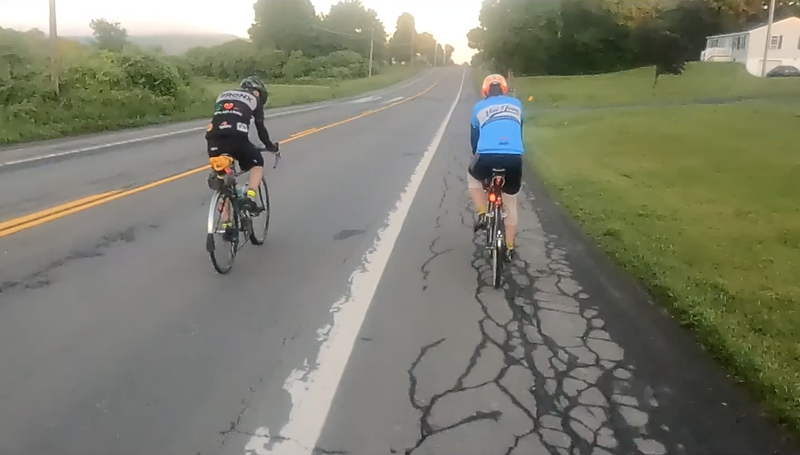 Paul and JB heading from Madison to Hamilton after sleep stop
As the sun rises, it lights up the mist. I'm occasionally on a hillside looking down into a pillowy valley or enshrouded in a bright haze. I try to take advantage of downhills but don't work too hard on the climbs, lest I pull some muscle that hasn't had time to loosen up yet. Paul and JB catch up and pass me by before I reach Morrisville on my way north again. I'm not going to try to keep up and decide to ride like I'm supposed to, at my own pace.
I pass through Peterboro before starting a descent off the Allegheny Plateau back into the Lake Ontario Lowlands. You can see most of Oneida Lake from this descent for a short while, and I relish the site for as long as I can while picking up speed.
After crossing NYS Route 5, I make a wrong turn to add an extra mile before the information control in Durhamville. As I get back on the cycle path, I meet an older couple on touring bikes. They are loaded light, spending nights in hotels along the trail, heading east. The husband is talkative and eager to tell me about their trip, their love of cycling, and little details about their gear. His wife is less conversational and more set on the task ahead of them. I got the impression she didn't miss me much when I left them after our mile together and headed towards Sylvan Beach on Jug Point Road.
I stopped at a convenience store in Sylvan Beach on the east shore of Oneida Lake to fill up the bottles just before 9:30 am. Paul and JB are just leaving as I get out of the store. The white exterior wall of the store is covered with a hatch of mayflies that have all heads pointing up, tails down. I remember when I was younger seeing much larger swarms of insects around Sylvan Beach, and I imagine what it would have been like to bike through those swarms. I am grateful that I am not.
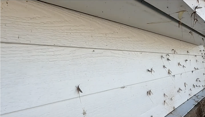 Mayfly hatches frequent the shores of Oneida Lake
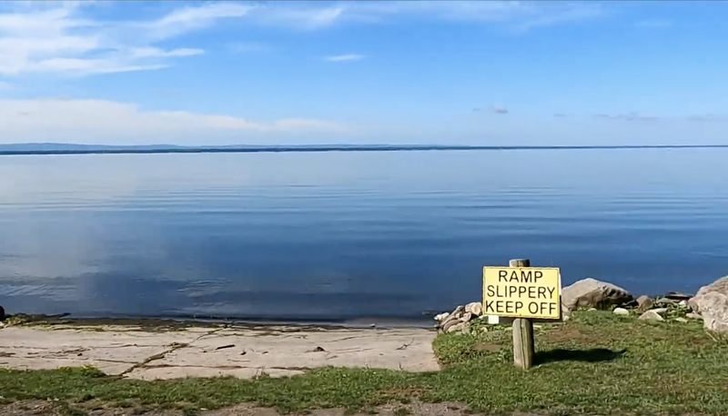 Windless day on Oneida Lake
Sylvan Beach to Fulton: 52 mi, 2200 ft of climbing
As the sun continues its climb, I'm starting to feel the heat of the day and getting pretty sore in the saddle. I think I'm starting to chafe despite having spared no chamois cream this morning. After riding out of town, I confirm that no cars are within sight and apply a thick smear of Lantiseptic "where the sun doesn't shine" and sunscreen to all the rest.
The roads north of the lake are a constant set of rollers. I feel that I am slowing down quite a bit. There doesn't seem to be any towns out here. It's all beautiful, but I can't stop thinking about the ever-passing time, my slowing average speed, and each energy-sapping miniature climb. I've read about the continuous hills during PBP and imagine this must be pretty close to the scene. I don't know which would be worse, a few long slogs or this. I'm drinking plenty of water but feel like I'm starting to overheat.
The original control in Fulton is marked on the cue sheet as the Grist Mill Restaurant. Unfortunately, it's located a third of a mile down a detour road from the road I'm on. The RBA had said we didn't have to go there; any business in town would suffice, so I picked a gas station near the I81 overpass. I'm sure the food at the restaurant is excellent, but I don't have time for a sit-down meal anyway. I reason that this is an even exchange for my missed turn near the Erie Canal earlier and consider the matter closed.
I felt like I was suffering from some mild heat exhaustion, so I bought a few cold bottles of water and went outside in the parking lot. I drink a bottle, fill up the bottles on the bike, and pour a bottle on my head and down my back. There are other, less dramatic ways to achieve cooling, but this one worked for me. I hang around at the control for about 30 minutes and get moving again at 12:45 pm.
There are another 22 miles of the same sort of terrain and heat to get to Fulton. I'm barely moving, I'm going 20 mph, I'm crawling in the granny gears, I'm flying again...over and over. Somewhere in this stretch, the Ride with GPS phone app I use (as a chatty companion an eTrex30x and the official cue sheets) starts to tell me things that don't make sense. I have it configured to announce my average speed for the segment and the time left to reach my destination. It's been tracking with my rando-math until now, but it suddenly seems to think I won't make it in time. The cue sheet says that the final control closes at 10 pm, but we started an hour early, so I have to remind myself that it actually closes at 9 pm. I keep repeating my math in my head and conclude that the computer is inexplicably making arithmetic errors, which is sort of hard to convince yourself of. This happened every few miles for the rest of the trip until I was very close to the final control.
This adventure has migrated from sights and sounds to mind over matter. The tally of woes include sore muscles, sore ass, sore hands, I'm hot and doubting my ability to do basic math, and I'm getting tired. After crossing the Oswego River for the second time in Fulton, I stop at a gas station with a clock on the wall that reads the wrong time. This adds to my anxiety, and I have to recheck everything. I repeat the water-bottle-over-the-head trick and rest outside in the shade of the store for 20 minutes until 3 pm. There are a little more than 50 miles to go and 6 hours to do it.
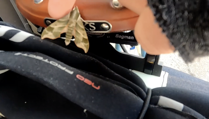 Moth on my saddle
Fulton to Ontario: 52 mi, 1950 ft of climbing
It's was surprising to me how far away Fulton was from the end of the ride. I was ready to be done. At some point near the end of every ride, I've felt like this. "That'll do, bring the van up and let's drive the rest, Jeeves."
The hills kept rising and falling in much the same annoying fashion they have since Sylvan Beach. The hills became a "frenemy" character in my mind, acting as both my benefactor and nemesis, more the latter than the former at the point in the ride. It was becoming difficult to spend much time sitting in the saddle. Instead, I found myself suddenly compelled to do a lot of standing climbs to push myself over each crest. I was surprised that I seemed to have a second wind and strength in my legs to do it. At this point, there wasn't a lot of reason to hold anything in reserve, so I pulled harder on the bars and pushed bigger gears during climbs before settling gingerly back onto the saddle at the top of each hill. I made subtle changes to my position to find some spot that felt ok. Unfortunately, there wasn't any such position.
The sun was going down, and the apple trees cast long shadows in their orchards along the lake. Sodus Bay went by on the opposite side of the road as it had the previous morning. I finished the route around 8:30 pm with 30 min to spare.